
On a summer Friday afternoon, I took a half-day from work and completed a multi-modal journey to rural Montgomery County, Md. and back to Washington, D.C. I took my bicycle with me on the 1:30 p.m. MARC Brunswick line from Union Station to Dickerson.
GETTING THERE: Taking a bike on MARC’s Brunswick line to get to the C&O Canal

$7 and about 55 minutes later, I had reached the rolling hills of the Montgomery County Agricultural Reserve. I suspect driving a car would have taken longer. Along the way I saw a few cute little stations between DC and Rockville. It was my first time on the Brunswick line.
Dickerson train station to the C&O
The tiny Dickerson station is just a couple of miles of two-lane country roads1 to the Monocacy Aqueduct entrance of the park. There is parking for both the Aqueduct and towpath.

I took a brief sidequest to Dickerson Market for a Pepsi tallboy and fried chicken which was quite good.
The roads were not crowded and the speed limit was under 40 MPH, so I was not too concerned, though your risk tolerance may vary. Would I feel a little better in a group? Sure, but once I got off of MD 28, I didn’t see (m)any cars.
Towpath – MP 42 to 22

I entered the Tow Path at the Monocacy Aqueduct. It’s the longest of the aqueducts along the canal. The best view and access are not directly served by the tow path, so stay on the road after the split. Keep in mind, the pavement is pretty rough and it’s a descent and thus, a climb back up to the towpath entry.
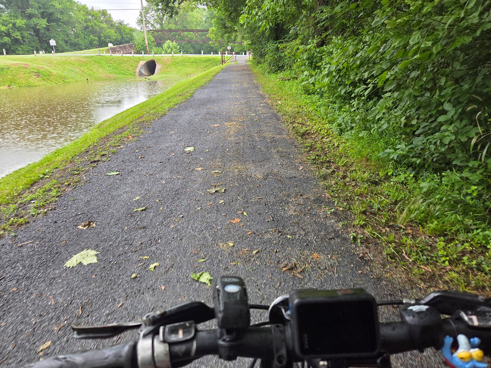
Being familiar with the Tow Path at Great Falls and in the District, I was pleasantly surprised at the hard-packed dirt trail at milepost 42. There are cinders in it as well. Overall, it was comparable or better to paved roads in many places. There were occasional puddles and mud, but it was generally manageable.

Generally speaking, the vista was constant – tall, mature trees and the canal on the left. Sometimes the Potomac River was visible, sometimes it was not. The grade was quite level of of course, with mild downslopes at locks. A few miles into the ride, the decommissioned Dickerson Generating Station2 abuts the trail. It was interesting being so close after so many years of the seeing the tall stack.

Around milepost 33.5, the towpath meets Whites Ferrry Road. While the actual ferry has been closed3 for several years, Whites Ferry Grill4 is a welcome oasis. I picked up some more water and a sticker. Locals were inside drinking beer.

The Friday afternoon I visited was overcast with slight rain. It was also extremely sticky. I sweated through my clothes within a few miles.
After Whites Ferry, it’s back to the wilderness. If you didn’t get snacks you have a long way to go until the next opportunity. There are pumps to water wells every few miles adjacent to camp sites. Occasionally, there is a lock which means a little downslope. The Potomac isn’t always visible either as it gets pretty woody at times. Over in Virginia, a few riverside golf courses come into view, but mostly, it’s just forests, the canal and river.
Towpath – MP 22 to 0
Around milepost 22, the towpath changes. While the previous 20 miles of my ride were pretty smooth, the condition changes to a rockier ride.

Candidly, I did not enjoy this part of the ride as much. I found myself wishing for thicker tires and at times, reminding myself why I rarely bike on the the towpath closer to the Beltway.
The scenery is still similar, though at times, civilization on the Northern Virginia shoreline is visible. More people started appearing on the trail too, but overall, it was quite isolated. On that muggy afternoon, I did not take many photos either.
In the Great Falls area, the towpath got bumpier with occasional roots and larger rocks. There were also more people on bikes and on foot.

Inside the Capital Beltway, the towpath is detoured around the infamous DC Water Potomac Interceptor Collapse. This required dismounting.
Thankfully, it was not particularly stinky.

From there on down, it was just a few more miles. Near Fletchers Boathouse, the Capital Crescent Trail becomes parallel and you can be forgiven if you deviate onto that paved path instead. Depending on the time of day, Fletchers Boathouse is open for snacks and beverages too.
I arrived in Georgetown about 4 hours and 10 minutes after I started.
US Bicycle Route 50
Technically, the C&O towpath is part of US Bicycle Route 50. However, there are no signs indicating it, confirming my 2013 blog post’s expectation. Such a shame.
On the other hand, there are mileposts along the towpath, though they are not posted every mile. Perhaps this is an opportunity for some enterprising scouts to do a service project for their Eagle or Gold Award. It sure as hell won’t happen with the current regime in power.

Other thoughts
As mentioned earlier, this seemingly works best in summer when the sun sets after 8 p.m. I suppose May might be ideal because it would likely not be as hot or humid as say, July. On a less hot & humid day, I probably could have made the ride 30 minutes faster with fewer stops and more efficient riding.
This may be the most isolated part of the immediate D.C. are if you are thinking counties that border the District. Packing water, food, bike repair kit/inner tubes6 and towels7 is a must as there are only a few places to pick anything up. Well-water may or may not be potable. I really needed the calories too, so pack a lot of snacks.
This is not a ride for skinny tires, especially the last 22 or so miles to D.C. I’m disinclined from doing that part of the ride again anytime soon. I feel bad for the Great Allegheny Passage/C&O Canal8 through-riders who get the likely worse surface of the 300+ miles journey in the last 10% or so of the trip.
Overall though, it’s a great adventure for experienced cyclists and anybody who likes using trains for bike touring. I’m glad I did it.
Footnotes
- Fun fact: Montgomery County’s Clopper Road was the original inspiration for the song “Country Roads.” Really. ↩︎
- A data center is proposed at this site – Updated plans for proposed Dickerson data center now online for public view – Bethesda Magazine ↩︎
- There may be progress on it reopening: Va. co-owner’s donation of White’s Ferry paves way for Potomac River crossing’s reopening (Virginia Mercury) ↩︎
- If I do this again, I’ll get food there. They could use the support since the ferry shutdown. ↩︎
- Full disclosure: a client of mine ↩︎
- The night before my ride, a former co-worker posted on social media that he “changed one of his kids bike tires with minimal blood loss. That gave me…the fear. I did not want to blow a tire 20 miles from anything, so I stopped at a The Daily Rider on my way to Union Station. Thankfully, no repairs were needed. ↩︎
- “A towel is just about the most massively useful thing an interstellar hitchhiker can carry.” ↩︎
- I want to ride this from Pittsburgh to D.C. some day. I’ll need a better saddle though… ↩︎