In my search for “new” bike trails, I identified the Sligo Creek Trail as a candidate. It’s mostly inside the Beltway and pretty Metro accessible. I figured I would get to it soon.
It turned out to be sooner than I thought.
Chris Roell organizes weekly Urban Adventure Bicycle Rides (Facebook).1 I’ve been on several of them and one November weekend, he choose a route that included Sligo Creek Trail. Impeccable timing, sir. We departed from East Potomac Park, winding our way up the Anacostia Trail and picked up the Northwest Branch Trail. The Sligo Creek Trail stars at the mouth of the stream it is named for in Chillum.
Prince George’s County
The trail begins at a T intersection with the Northwest Branch Trail about ½ from the West Hyattsville metro station. That had been my plan to access the trail before the Urban Adventure ride opportunity came up.
According to whatsmyelevation.com2, the southern terminus is 36 feet above sea level. The first mile or so is dedicated right of way and the trail is about six feet wide. At Sligo Parkway, the trail merges into mix traffic for about 500 feet before Riggs Road (MD 212). The crossing is at grade and not signalized.
Across Riggs Road, the trail resumes along it own right of way for about ½ mile before another at grade crossing. There is a crosswalk at East West Highway (MD 410) and flashing beacons, but not red-yellow-green signals. There are also gates that essentially force cyclists to stop or slow down considerably. Like Riggs Road, it’s a stressful crossing.

Less than ¼ from East West Highway, the trail passes under two sets of high tension power lines. This was also the final proposed alignment of Interstate 95 Northeast Freeway3 before it was rerouted along the Capital Beltway in 1977.
Montgomery County
Crossing the Montgomery County line, the landscape becomes more hilly. The trail crosses the creek more frequently as the streams winds through the contours of the land.
At New Hampshire Ave. (MD 650), the trail crosses at a signalized intersection. By the point, there has been 60 feet of elevation gain. Though it was probably past peak for foliage, the trail was still beautiful. The ride leader mentioned he preferred this time since the creek was more visible through the trees.
There is a left turn at the low-stress Garland Ave. and Flower Ave. t-intersection as well.

Now paralleling the Sligo Creek Parkway, the trail goes through neighborhoods with fairly large housing lots and mature trees. There seems to be a playground adjacent to the trail every mile or so.

The beautiful Carroll Ave. Bridge (MD 195) spans the small valley that the creek, trail and parkway travel through. Built in 1932 and refurbished in 2015, the three concrete arches are a highlight of the ride.
Crossings at Maple Ave. (167 feet above sea level) and Park Valley Ave. (170 feet above sea) and the scenary is similar. Bridges across Sligo Creek are frequent as the trail takes a more direct route than the stream.
Portions of Sligo Creek Parkway are also closed to cars on weekends, so that’s another option for bicycling through the corridor. Our ride choose this option at times.
At Piney Branch Parkway (MD 320) the trail is an viaduct up to the signalized intersection with the trail and parkway. Immediately after, the trail passes through a parking area before resuming a dedicated right of way. Half a mile later, there is another at grade signalized intersection with Wayne Ave. which is also the future Purple Line.4 It’s a bit of a mess right now, as can be expected.

Not long after Wayne Ave., the trail becomes directly adjacent to the parkway with a little bit of lawn between them for the most part, including the 5 point intersection at Colesville (US 29) and St. Andrews roads. It even shares pavement with a parking lot a times.
Following about one mile of that, the trail breaks off and crosses Silgo Creek on a separate alignment. By now, the elevation is about 260 feet.
At Flora Ave. the ride broke off, but I continued under the Capital Beltway (I-495)5 to get to the Forest Glen Metro station.6
I actually missed the turn at Forest Glen Road, a crosswalk with beacons, and continued a little further before doubling back. By now, the elevation was about 280 feet and overall, it was pretty imperceptible – the trail is pretty flat.
The trail continues another 2⅓ or so miles pass University Blvd. (MD 193) and reaching an elevation of about 400 feet. It was windy day and opted to save that last stretch for another time.
Map
Much of the trail is available on streetview.
Other observations
- I was quite pleased with how beautiful the trail was as it rolled through the woods and the Sligo Creek valley. It goes through old line, leafy inner suburbs in Montgomery County. I think a week earlier the foliage would have been peak and the trail would have been much more crowded.
- It’s flaaaaaaaat. Elevation change is barely noticeable.
- The trail is narrow, but the pavement and bridges are in a good shape, so as much as widening would be welcome, I don’t see it in the near term. It’s not built for speed which is okay.
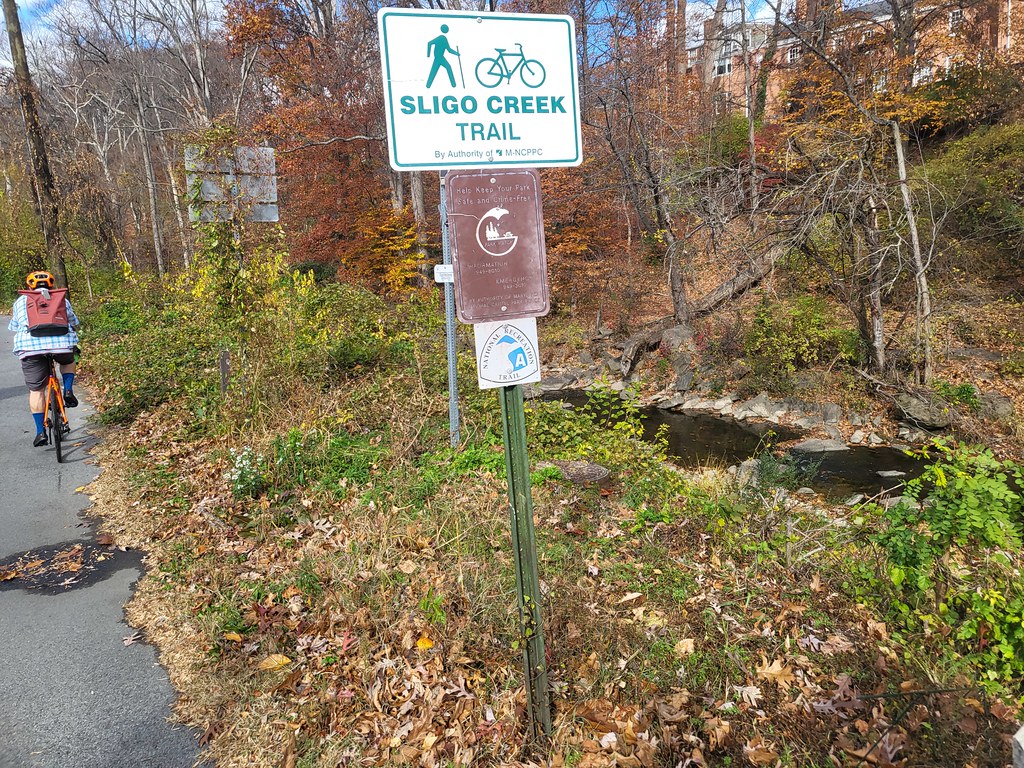
- The signage is at or above average in Prince George’s and most of Montgomery County up until the area near the Beltway. One quibble – there should be signs to the nearby Metro stations. I missed the turn to Forest Glen.
More Sligo Creek Trail links
Montgomery Parks | Trail Link | Friends of Sligo Creek
Footnotes
- Typically, Chris leads “hill rides” on Saturday and “touring rides” on Sunday. ↩︎
- Kind of slow, lots of ads, but it did the job. ↩︎
- Northeast Freeway (Washington, D.C.) – wikipedia ↩︎
- Projected opening 2027 after 10 years and many delays for several reasons ↩︎
- The “roller coaster section” ↩︎
- My 31st Metro station entered/exited/transfer at of 2025 and first time ever using this station. I’ve been keeping track of my annual station visits way before Metro Rewind. ↩︎